![]()
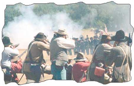
Civil War reenactments take place each fall at Running Creek Ranch
Up the road
BY KATHY SMITH
Do those of you who are baby-boomers, or older, remember hearing your father say, "Come on kids, let's go for a drive!?" Those were exciting little excursions--mom might pack a picnic lunch, ice down some soda pop and off we'd go!
Take a trip down memory lane and discover the beauty and serenity that surround us in Hood County.
There are 430 miles of county roads in Hood County and most of them are full of geology, nature and history lessons.
Starting today, and continuing once a month, we'll suggest a Sunday drive--some long, some short. We'll tell you a bit of what you'll see during your outing and also some of the history behind the places you'll pass along the way.
Don't forget the camera and bologna sandwiches!
* Paluxy Highway-Peak/Neri Road-Glen Rose Highway-15.6 miles
Start the drive at the Lake Granbury Medical Center on Paluxy Highway. Go south on Paluxy Highway (Hwy 51), approximately 2.10 miles. Turn left on Peak Road. The property on your left, is the Running Creek Ranch--the General Granbury's Civil War Reenactment is held on this property in the fall. Stay on Peak Rd. approximately 2.5 miles and you will be at the foot of the majestic Comanche Peak. Comanche Peak rises 1,245 feet above sea level and is not a peak, but is a mesa. The Comanche Indians called it Que Tah To Ya, which means Rocky Butte. It is considered by many members of the Comanche nation to be the site where Comanche Chief Quanah Parker went for his vision quest as a young brave.
When Texas joined the Union in 1845 a pow wow was held on Comanche Peak with all of the Indian tribes in Texas--Caddos, Apaches, Tonkawas and Comanches. Also in attendance were government officials from Washington, D.C. and Texas. It was during this meeting that the G-men told the Indians, "Not only are you going to have to deal with the Texicans, but now you'll have to deal with the great white fathers in Washington, too."
Comanche Peak is privately owned, but is occasionally opened to the public for a picnic sponsored by the Historic Preservation Society.
Continuing on Peak Rd, you'll turn left on Neri Road, a little more than a mile from Comanche Peak. Then, take a right on Pear Orchard Road. For the next one and a half to two miles, the scenery is great. Beautiful ranch houses, roadway ditches littered with petrified wood, and, in the spring, tons of wildflowers.
Pear Orchard Road will take you to the Glen Rose Highway (Hwy 144). Turn left to Granbury.
Just down and across the highway a bit (near the intersection with FM 2425) was the small community of Neri, pronounced "knee-rye."
Neri was one of many thriving little communities Hood County had at the turn-of-the-century, such as Fairview, Waples and Mambrino. The Neri School operated until the middle to late 1930s.
Stay on Hwy 144 north to Granbury. Along the way, you'll see the historical marker for Comanche Peak and one of the best views around of the Peak.
Hope you enjoy the ride. Next time, we'll go west, young man (and woman)!